
Browse In:
Sort by
Items 1-
32
of 640 total
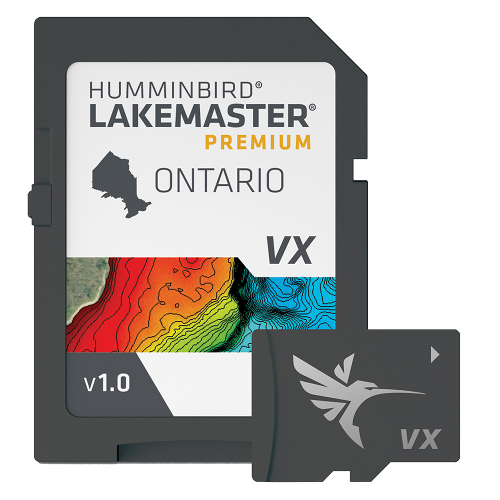
Humminbird LakeMaster VX Premium - Ontario
Humminbird LakeMaster VX Premium - Ontario
Online
$249.99 for Each
Retail $249.99
Mfr PN: 602020-1
Stock: 171
|
LakeMaster® VX Premium - Ontario An upgraded premium mapping solution in Humminbird LakeMaster VX to help anglers understand what is under the water’s surface better than ever before. For decades, Humminbird LakeMaster® has led the charge with the most accurate and advanced mapping available for anglers. Now, LakeMaster is taking it to an entirely new level with the introduction of Humminbird LakeMaster maps with VX Technology. The LakeMaster name has been praised among anglers for having the highest quality mapping for fishing, often collected by a team of GIS analyst cartographers. Now with VX Technology, LakeMaster maps are packed with more information than ever before, including five new customizable color palettes, exceptional map performance, and a powerful combination of features. The LakeMaster lineup maintains the same regions as the current lineup, but with two options per region: LakeMaster and LakeMaster Premium. Both products now include SmartStrike technology as a feature, allowing anglers to enter search parameters like season, time of day, temperature, and targeted fish species to create a custom chart that highlights areas of the map where fish are most likely to be biting. LakeMaster and LakeMaster Premium also include customizable Chart Presets, Depth Highlight, Shallow Water Highlight, Water Level Offset, and One-Boat Network capability. And for an added advantage, LakeMaster Premium includes two additional features: 2D Shaded Relief and Aerial Imagery. LakeMaster has been the go-to road map for anglers, and compared to the competition, what you see on the map is actually on the lake bottom. With LakeMaster with VX Technology, Humminbird LakeMaster solidifies its place as the most accurate and detailed fishing map on the market. Features:
|
Online
$249.99 for Each
Retail $249.99
Mfr PN: 602020-1
Stock: 171
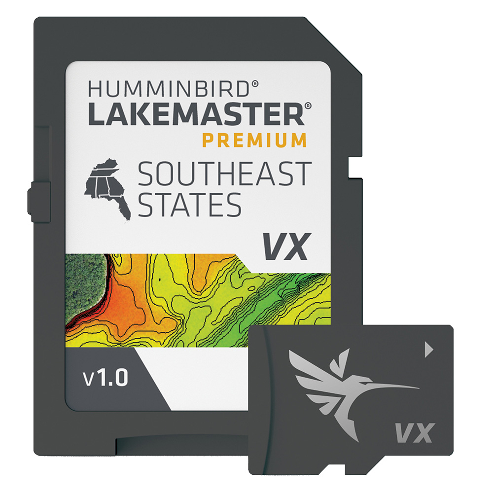
Humminbird LakeMaster VX Premium - Southeast
Humminbird LakeMaster VX Premium - Southeast
Online
$199.99 for Each
Retail $199.99
Mfr PN: 602008-1
Stock: 111
|
LakeMaster® VX Premium - Southeast An upgraded premium mapping solution in Humminbird LakeMaster VX to help anglers understand what is under the water’s surface better than ever before. For decades, Humminbird LakeMaster® has led the charge with the most accurate and advanced mapping available for anglers. Now, LakeMaster is taking it to an entirely new level with the introduction of Humminbird LakeMaster maps with VX Technology. The LakeMaster name has been praised among anglers for having the highest quality mapping for fishing, often collected by a team of GIS analyst cartographers. Now with VX Technology, LakeMaster maps are packed with more information than ever before, including five new customizable color palettes, exceptional map performance, and a powerful combination of features. The LakeMaster lineup maintains the same regions as the current lineup, but with two options per region: LakeMaster and LakeMaster Premium. Both products now include SmartStrike technology as a feature, allowing anglers to enter search parameters like season, time of day, temperature, and targeted fish species to create a custom chart that highlights areas of the map where fish are most likely to be biting. LakeMaster and LakeMaster Premium also include customizable Chart Presets, Depth Highlight, Shallow Water Highlight, Water Level Offset, and One-Boat Network capability. And for an added advantage, LakeMaster Premium includes two additional features: 2D Shaded Relief and Aerial Imagery. LakeMaster has been the go-to road map for anglers, and compared to the competition, what you see on the map is actually on the lake bottom. With LakeMaster with VX Technology, Humminbird LakeMaster solidifies its place as the most accurate and detailed fishing map on the market. Features:
|
Online
$199.99 for Each
Retail $199.99
Mfr PN: 602008-1
Stock: 111

Garmin 010-02036-06 Drive 52 5" GPS Navigator
Garmin 010-02036-06 Drive 52 5" GPS Navigator
Online
$151.99 for EA
Mfr PN: 010-02036-06
Stock: 82
|
• GPS navigator;• Preloaded, detailed maps of US & Canada with map updates;• Simple on-screen menus & bright, easy-to-see maps;• Driver alerts for upcoming sharp curves, speed changes, railroad crossings & more;• Road trip-ready with The HISTORY Channel(R) database of notable historic sites, a US national parks directory, TripAdvisor(R) traveler ratings & millions of Foursquare(R) POIs;• Provides spoken turn-by-turn directions & Garmin Real Directions(TM) landmark guidance;• Compatible with optional BC(TM) 30 wireless backup camera;• Includes vehicle power cable, vehicle suction-cup mount, USB cable & quick-start manual;
|
Online
$151.99 for EA
Mfr PN: 010-02036-06
Stock: 82
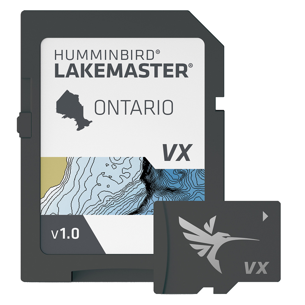
Humminbird LakeMaster VX - Ontario
Humminbird LakeMaster VX - Ontario
Online
$149.99 for Each
Retail $149.99
Mfr PN: 601020-1
Stock: 69
|
LakeMaster® VX - Ontario An upgraded mapping solution in Humminbird LakeMaster VX to help anglers understand what is under the water’s surface better than ever before. For decades, Humminbird LakeMaster® has led the charge with the most accurate and advanced mapping available for anglers. Now, LakeMaster is taking it to an entirely new level with the introduction of Humminbird LakeMaster maps with VX Technology. The LakeMaster name has been praised among anglers for having the highest quality mapping for fishing, often collected by a team of GIS analyst cartographers. Now with VX Technology, LakeMaster maps are packed with more information than ever before, including five new customizable color palettes, exceptional map performance, and a powerful combination of features. The LakeMaster lineup maintains the same regions as the current lineup, but now includes SmartStrike technology as a feature, allowing anglers to enter search parameters like season, time of day, temperature, and targeted fish species to create a custom chart that highlights areas of the map where fish are most likely to be biting. LakeMaster also includes customizable Chart Presets, Depth Highlight, Shallow Water Highlight, Water Level Offset, and One-Boat Network capability. LakeMaster has been the go-to road map for anglers, and compared to the competition, what you see on the map is actually on the lake bottom. With LakeMaster with VX Technology, Humminbird LakeMaster solidifies its place as the most accurate and detailed fishing map on the market. Features:
|
Online
$149.99 for Each
Retail $149.99
Mfr PN: 601020-1
Stock: 69

Raymarine LightHouse Chart North America
Raymarine LightHouse Chart North America
Online
$159.56 for Each
Mfr PN: R70794
Stock: 61
|
LightHouse Chart North America LightHouse Charts North America chart coverage includes coastlines of the contiguous United States, Alaska, Hawaii, thousands of inland freshwater bodies of water, and the Bahamas. The chart also includes The Great Lakes, British Columbia, The St. Lawrence River, the coastlines of Newfoundland, Nova Scotia, Prince Edward Island, and New Brunswick. LightHouse Charts brings a level of clarity and control to marine navigation. Created from official hydrographic chart sources, LightHouse Charts offer maximum readability, intuitive navigation, and superior quality. Four distinct color palettes provide the best possible viewing conditions around the clock, and chart symbol controls give your customers the power to customize the charts to their personal preference. LIGHTHOUSE CHARTS PREMIUM LightHouse PREMIUM is an annual subscription for LightHouse Chart users valued at $49 per year. The service provides regular chart updates, access to an expanded point of interest library, including local marina data from Marinas.com and Mapbox powered high-resolution satellite imagery. As a first-year introductory offer, LightHouse PREMIUM features are FREE for all LightHouse Chart purchases through May of 2022. IMPORTANT Tech Note: Please ensure your customer's Axiom displays are running the latest operating system when using LightHouse Charts. LightHouse Fremantle 3 is required for running LightHouse Charts North America. |
Online
$159.56 for Each
Mfr PN: R70794
Stock: 61
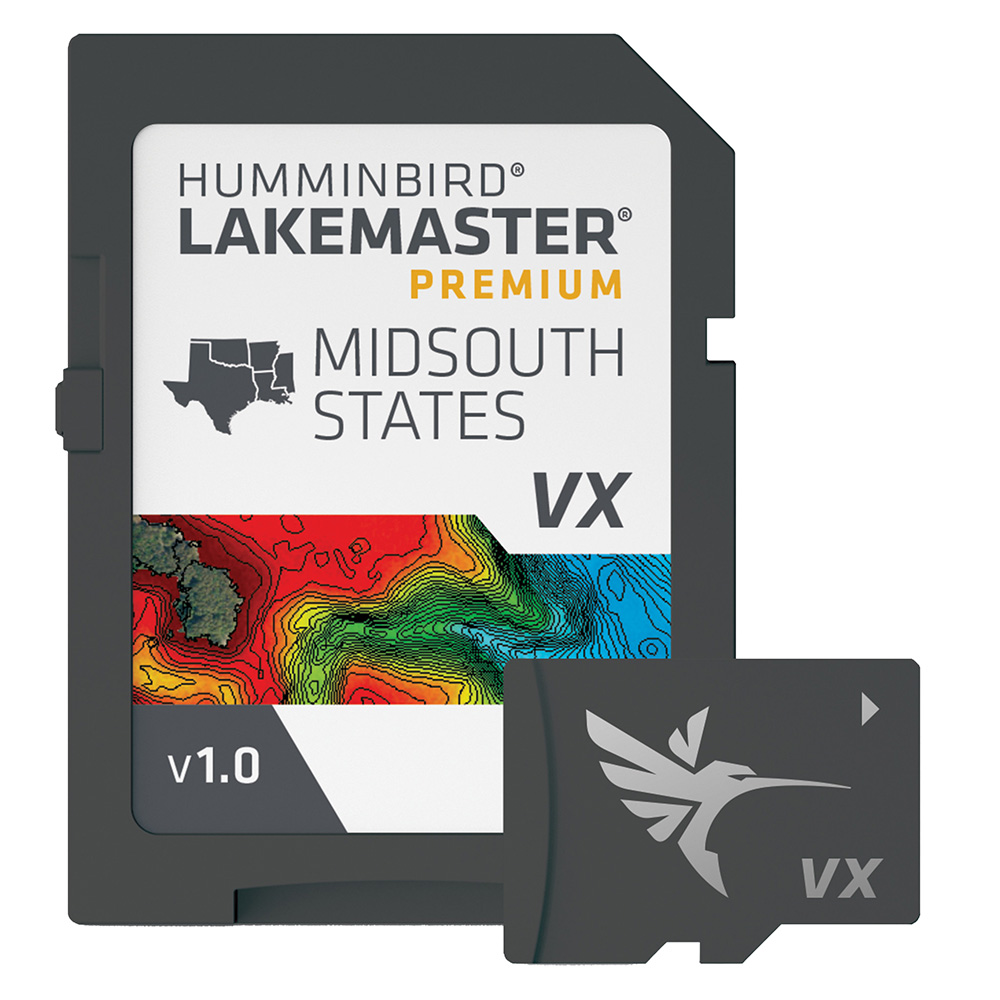
Humminbird LakeMaster VX Premium - Mid-South States
Humminbird LakeMaster VX Premium - Mid-South States
Online
$199.99 for Each
Retail $199.99
Mfr PN: 602005-1
Stock: 58
|
LakeMaster® VX Premium - Mid-South States An upgraded premium mapping solution in Humminbird LakeMaster VX to help anglers understand what is under the water’s surface better than ever before. For decades, Humminbird LakeMaster® has led the charge with the most accurate and advanced mapping available for anglers. Now, LakeMaster is taking it to an entirely new level with the introduction of Humminbird LakeMaster maps with VX Technology. The LakeMaster name has been praised among anglers for having the highest quality mapping for fishing, often collected by a team of GIS analyst cartographers. Now with VX Technology, LakeMaster maps are packed with more information than ever before, including five new customizable color palettes, exceptional map performance, and a powerful combination of features. The LakeMaster lineup maintains the same regions as the current lineup, but with two options per region: LakeMaster and LakeMaster Premium. Both products now include SmartStrike technology as a feature, allowing anglers to enter search parameters like season, time of day, temperature, and targeted fish species to create a custom chart that highlights areas of the map where fish are most likely to be biting. LakeMaster and LakeMaster Premium also include customizable Chart Presets, Depth Highlight, Shallow Water Highlight, Water Level Offset, and One-Boat Network capability. And for an added advantage, LakeMaster Premium includes two additional features: 2D Shaded Relief and Aerial Imagery. LakeMaster has been the go-to road map for anglers, and compared to the competition, what you see on the map is actually on the lake bottom. With LakeMaster with VX Technology, Humminbird LakeMaster solidifies its place as the most accurate and detailed fishing map on the market. Features:
|
Online
$199.99 for Each
Retail $199.99
Mfr PN: 602005-1
Stock: 58

Humminbird AutoChart Zero Lines Map Card
Humminbird AutoChart Zero Lines Map Card
Online
$84.69 for Each
Retail $99.99
Mfr PN: 600033-1
Stock: 56
|
AutoChart Zero Lines Map Card
AutoChart: The starting point to your mapping adventure. The Zero Line is the place where the water meets the shore. It's also the starting point for building your own maps with AutoChart. With these all-important Zero Lines as your foundation, you can begin creating your own, accurate and detailed maps of any fishing spot, even where contour coverage doesn't exist. Anglers can purchase additional Zero Line Map Cards to view the AutoChart created maps on multiple Humminbird units. Simply export the map from the PC program to the extra Zero Line Map Cards and you'll have multiple charts of your favorite fishing spots ready to view on a range of compatible* Humminbird fish finders. *Optional for select ONIX, ION, 1100, 900, 800, and 600 Series models. Compatibility subject to change without notice. Specifications:
|
 WARNING: This product can expose you to chemicals including Naphthalene which is known to the State of California to cause cancer. For more information go to
 Online
$84.69 for Each
Retail $99.99
Mfr PN: 600033-1
Stock: 56
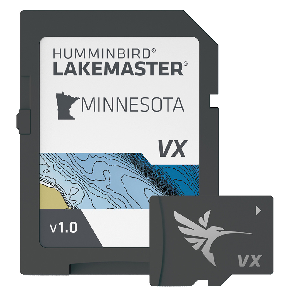
Humminbird LakeMaster VX - Minnesota
Humminbird LakeMaster VX - Minnesota
Online
$149.99 for Each
Retail $149.99
Mfr PN: 601006-1
Stock: 54
|
LakeMaster® VX - Minnesota An upgraded mapping solution in Humminbird LakeMaster VX to help anglers understand what is under the water’s surface better than ever before. For decades, Humminbird LakeMaster® has led the charge with the most accurate and advanced mapping available for anglers. Now, LakeMaster is taking it to an entirely new level with the introduction of Humminbird LakeMaster maps with VX Technology. The LakeMaster name has been praised among anglers for having the highest quality mapping for fishing, often collected by a team of GIS analyst cartographers. Now with VX Technology, LakeMaster maps are packed with more information than ever before, including five new customizable color palettes, exceptional map performance, and a powerful combination of features. The LakeMaster lineup maintains the same regions as the current lineup, but now includes SmartStrike technology as a feature, allowing anglers to enter search parameters like season, time of day, temperature, and targeted fish species to create a custom chart that highlights areas of the map where fish are most likely to be biting. LakeMaster also includes customizable Chart Presets, Depth Highlight, Shallow Water Highlight, Water Level Offset, and One-Boat Network capability. LakeMaster has been the go-to road map for anglers, and compared to the competition, what you see on the map is actually on the lake bottom. With LakeMaster with VX Technology, Humminbird LakeMaster solidifies its place as the most accurate and detailed fishing map on the market. Features:
|
Online
$149.99 for Each
Retail $149.99
Mfr PN: 601006-1
Stock: 54

Garmin Navionics Vision+ NVSA010R Central America & Caribbean
Garmin Navionics Vision+ NVSA010R Central America & Caribbean
Online
$149.98 for Each
Retail $249.99
Mfr PN: 010-C1451-00
Stock: 53
|
Navionics Vision+™ NVSA010R Central America & Caribbean Featuring vibrant colors, a streamlined interface, and combined coastal/inland content with a popular Navionics® style color palette, Garmin Navionics+ cartography makes it easy to plot courses with the world’s No. 1 name in marine mapping.
Coverage Detailed coverage of the west coast of Mexico from Tijuana to Panama. Including the Panama Canal in its entirety. East Coast coverage from Panama to Brownsville, TX. Also includes detailed Caribbean coverage of the Far Bahamas, Turks & Caicos, Cuba, Jamaica, the Caymans, Haiti, the Dominican Republic, Puerto Rico, and the Lesser Antilles to Grenada. All-In-One Map Solution for Garmin Chartplotters Access detail-rich mapping of coastal features, lakes, rivers, and more. Integrated Garmin and Navionics® content offers coverage for boaters worldwide. Daily Chart Updates Charts are constantly being enhanced with new and amended content — as many as 5,000 updates are made every day. The one-year subscription includes access to daily chart updates via the ActiveCaptain app. Auto Guidance+ Technology Combining the best of Garmin and Navionics automatic routing features, built-in Auto Guidance+ technology2 gives users a suggested dock-to-dock path to follow through channels, inlets, marina entrances, and more. Depth Range Shading High-resolution depth range shading lets users select up to 10 color-shaded options and view the designated target depths at a glance. Up to 1’ Contours For improved fishing and navigation, up to 1' contours provide a clear depiction of bottom structure for improved fishing charts and enhanced detail in swamps, canals, harbors, marinas, and more. Shallow Water Shading To give a clear picture of shallow waters to avoid, this feature allows for shading at a user-defined depth. Raster Cartography NOAA raster cartography3 is available for some U.S. waters as a free downloadable feature via the ActiveCaptain app to provide paper chart-like views on a plotter. ActiveCaptain Community Community-sourced content provides useful POIs, such as marinas, anchorages, hazards, businesses, and more. Get recommendations from boaters with firsthand experience of the local environment. Add Premium Features with Garmin Navionics Vision+ Mapping Solutions High-Resolution Relief Shading This downloadable shading feature4 combines color and shadow to give users an easier-to-interpret, clearer view of the bottom structure than contour lines alone. Sonar Imagery The downloadable sonar imagery feature4 reveals bottom hardness clearly and in a contrasting color, highlighting both subtle and dramatic transition areas on select U.S. lakes. High-Resolution Satellite Imagery Downloadable high-resolution satellite imagery4 provides superior situational awareness. Aerial Photography Crystal-clear aerial and surface photos of ports, marinas, bridges, docks, boat ramps, dams, and navigational landmarks provide a better sense of the surroundings above the waterline. Side-Scan Images Side-scan images capture submerged features such as fallen timber, fish attractors, wrecks, potential hazards, and more on select U.S. lakes. 3D Fisheye View This underwater perspective shows a 3D representation of the bottom and contours as seen from below the waterline. Interface with sonar data for a customized view. 3D Marinereye View This view provides a 3D representation of the surrounding area, both above and below the waterline. Dynamic Lake Level Adjust the maps to the lake’s current water levels to see if spots are accessible or too shallow to explore. 1Auto Guidance+ is for planning purposes only and does not replace safe navigation operations 2Raster cartography cannot be viewed on echoMAP™ CHIRP and ECHOMAP™ Plus combos but can be viewed on mobile devices via the ActiveCaptain mobile app 3Subscription required; a one-year subscription, which is included with the purchase of the Navionics Vision+ mapping solution, lets users access daily chart updates and download additional content or premium features included with the cartography product |
Online
$149.98 for Each
Retail $249.99
Mfr PN: 010-C1451-00
Stock: 53
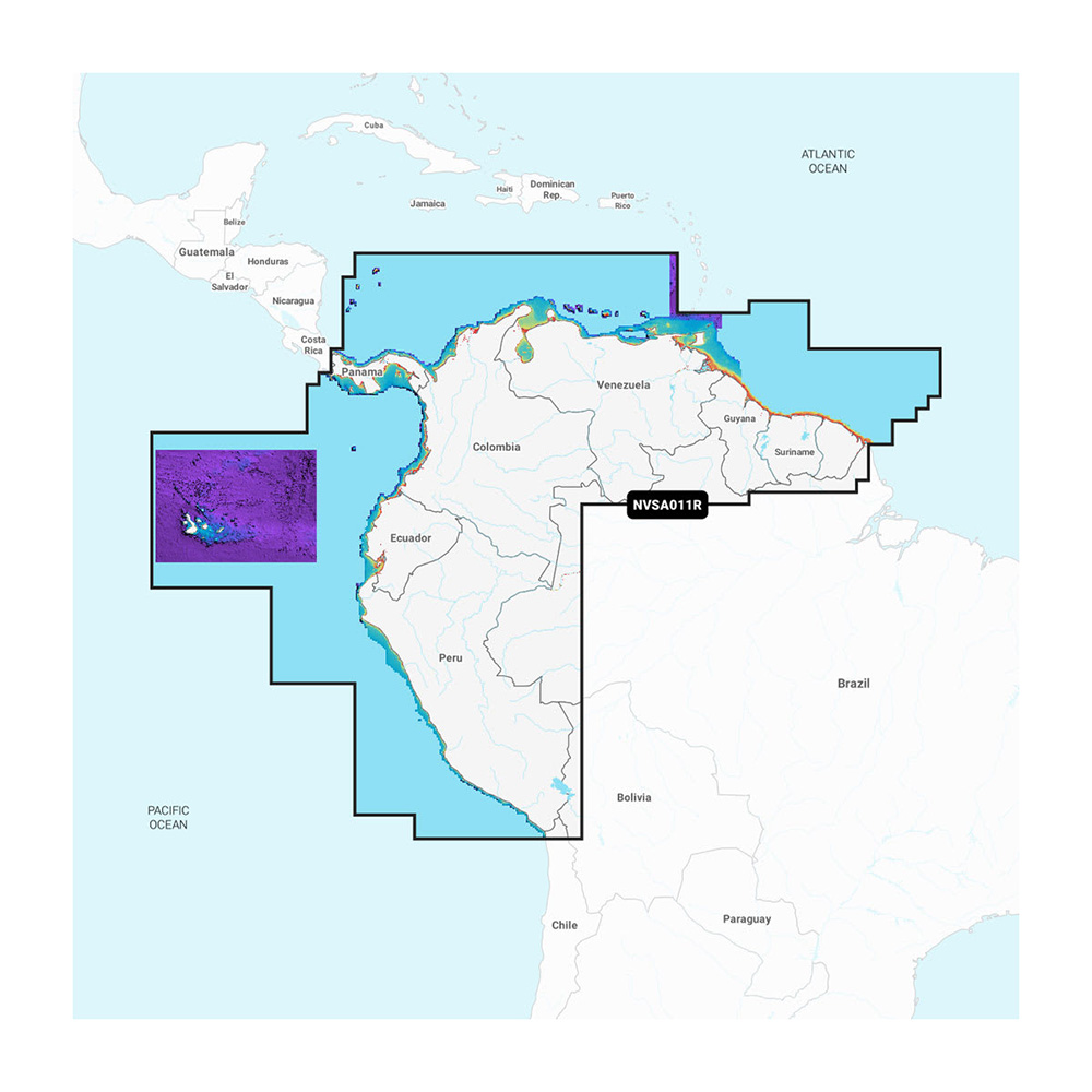
Garmin Navionics Vision+ NVSA011R South America (North)
Garmin Navionics Vision+ NVSA011R South America (North)
Online
$149.98 for Each
Retail $249.99
Mfr PN: 010-C1452-00
Stock: 53
|
Navionics Vision+™ NSSA011R South America (North) Featuring vibrant colors, a streamlined interface, and combined coastal/inland content with a popular Navionics® style color palette, Garmin Navionics+ cartography makes it easy to plot courses with the world’s No. 1 name in marine mapping.
Coverage Detailed coverage of the entire coast of Panama, including the Canal. Coastal coverage of Peru, Ecuador, Columbia, Venezuela, Trinidad and Tobago, Guyana, Suriname, and French Guiana. All-In-One Map Solution for Garmin Chartplotters Access detail-rich mapping of coastal features, lakes, rivers, and more. Integrated Garmin and Navionics® content offers coverage for boaters worldwide. Daily Chart Updates Charts are constantly being enhanced with new and amended content — as many as 5,000 updates are made every day. The one-year subscription includes access to daily chart updates via the ActiveCaptain app. Auto Guidance+ Technology Combining the best of Garmin and Navionics automatic routing features, built-in Auto Guidance+ technology2 gives users a suggested dock-to-dock path to follow through channels, inlets, marina entrances, and more. Depth Range Shading High-resolution depth range shading lets users select up to 10 color-shaded options and view the designated target depths at a glance. Up to 1’ Contours For improved fishing and navigation, up to 1' contours provide a clear depiction of bottom structure for improved fishing charts and enhanced detail in swamps, canals, harbors, marinas, and more. Shallow Water Shading To give a clear picture of shallow waters to avoid, this feature allows for shading at a user-defined depth. ActiveCaptain Community Community-sourced content provides useful POIs, such as marinas, anchorages, hazards, businesses, and more. Get recommendations from boaters with firsthand experience of the local environment. Add Premium Features with Garmin Navionics Vision+ Mapping Solutions High-Resolution Relief Shading This downloadable shading feature4 combines color and shadow to give users an easier-to-interpret, clearer view of the bottom structure than contour lines alone. High-Resolution Satellite Imagery Downloadable high-resolution satellite imagery4 provides superior situational awareness. Aerial Photography Crystal-clear aerial and surface photos of ports, marinas, bridges, docks, boat ramps, dams, and navigational landmarks provide a better sense of the surroundings above the waterline. 3D Fisheye View This underwater perspective shows a 3D representation of the bottom and contours as seen from below the waterline. Interface with sonar data for a customized view. 3D Marinereye View This view provides a 3D representation of the surrounding area, both above and below the waterline. Dynamic Lake Level Adjust the maps to the lake’s current water levels to see if spots are accessible or too shallow to explore. 1Auto Guidance+ is for planning purposes only and does not replace safe navigation operations 2Subscription required; a one-year subscription, which is included with the purchase of the Navionics Vision+ mapping solution, lets users access daily chart updates and download additional content or premium features included with the cartography product |
Online
$149.98 for Each
Retail $249.99
Mfr PN: 010-C1452-00
Stock: 53

Garmin Navionics Vision+ NVSA012R Brazil
Garmin Navionics Vision+ NVSA012R Brazil
Online
$149.98 for Each
Retail $249.99
Mfr PN: 010-C1453-00
Stock: 53
|
Navionics Vision+™ NVSA012R Brazil Featuring vibrant colors, a streamlined interface, and combined coastal/inland content with a popular Navionics® style color palette, Garmin Navionics+ cartography makes it easy to plot courses with the world’s No. 1 name in marine mapping.
Coverage Detailed coverage of the coast of Brazil. Also including the Amazon River from Benjamin Constant to the Atlantic Ocean. All-In-One Map Solution for Garmin Chartplotters Access detail-rich mapping of coastal features, lakes, rivers, and more. Integrated Garmin and Navionics® content offers coverage for boaters worldwide. Daily Chart Updates Charts are constantly being enhanced with new and amended content — as many as 5,000 updates are made every day. The one-year subscription includes access to daily chart updates via the ActiveCaptain app. Auto Guidance+ Technology Combining the best of Garmin and Navionics automatic routing features, built-in Auto Guidance+ technology2 gives users a suggested dock-to-dock path to follow through channels, inlets, marina entrances, and more. Depth Range Shading High-resolution depth range shading lets users select up to 10 color-shaded options and view the designated target depths at a glance. Up to 1’ Contours For improved fishing and navigation, up to 1' contours provide a clear depiction of bottom structure for improved fishing charts and enhanced detail in swamps, canals, harbors, marinas, and more. Shallow Water Shading To give a clear picture of shallow waters to avoid, this feature allows for shading at a user-defined depth. ActiveCaptain Community Community-sourced content provides useful POIs, such as marinas, anchorages, hazards, businesses, and more. Get recommendations from boaters with firsthand experience of the local environment. Add Premium Features with Garmin Navionics Vision+ Mapping Solutions High-Resolution Relief Shading This downloadable shading feature4 combines color and shadow to give users an easier-to-interpret, clearer view of the bottom structure than contour lines alone. High-Resolution Satellite Imagery Downloadable high-resolution satellite imagery4 provides superior situational awareness. Aerial Photography Crystal-clear aerial and surface photos of ports, marinas, bridges, docks, boat ramps, dams, and navigational landmarks provide a better sense of the surroundings above the waterline. 3D Fisheye View This underwater perspective shows a 3D representation of the bottom and contours as seen from below the waterline. Interface with sonar data for a customized view. 3D Marinereye View This view provides a 3D representation of the surrounding area, both above and below the waterline. Dynamic Lake Level Adjust the maps to the lake’s current water levels to see if spots are accessible or too shallow to explore. 1Auto Guidance+ is for planning purposes only and does not replace safe navigation operations 2Subscription required; a one-year subscription, which is included with the purchase of the Navionics Vision+ mapping solution, lets users access daily chart updates and download additional content or premium features included with the cartography product |
Online
$149.98 for Each
Retail $249.99
Mfr PN: 010-C1453-00
Stock: 53

OverDryve 8 Pro II
OverDryve 8 Pro II
Online
$653.32 for EA
Mfr PN: 8PROII
Stock: 48
|
OverDryve Pro II is a second-generation all-in-one dashboard device and truck GPS. With essential truck data, connected capabilities, and upgraded features like Rand Navigation 2.0, a fully-adjustable dash cam, and improved hardware OverDryve Pro II is the ultimate in-cab tool for professional drivers. This dedicated truck GPS is in a 7-inch or 8-inch screen size. Specifications
|
Online
$653.32 for EA
Mfr PN: 8PROII
Stock: 48

Navionics NAUS001L - U.S. & Coastal Canada - Navionics+
Navionics NAUS001L - U.S. & Coastal Canada - Navionics+
Online
$149.98 for Each
Retail $199.99
Mfr PN: 010-C1366-30
Stock: 44
|
NAUS001L - U.S. & Coastal Canada - Navionics+ Get the world’s No. 1 choice in marine mapping - with the best, most up-to-date Navionics+ cartography on your compatible chartplotter. For offshore or inland waters, this all-in-one solution offers detail-rich integrated mapping of coastal waters, lakes, rivers and more. Get SonarChart™ 1’ (0.5 meter) HD bathymetry maps, advanced features such as dock-to-dock route guidance technology, live mapping and Plotter Sync to provide wireless access to daily updates. The Navionics Chart Installer software also ensures the freshest chart data every time out. Navionics dock-to-dock route guidance solutions give you a suggested path to follow through channels, inlets, marina entrances and more. Multiple shading options aid in shallow water navigation and make it easy to highlight a target depth range for the best fishing spots. Chart Code - NAUS001L Coverage Area: Coverage of the entire U.S. coasts, lakes, rivers and inland waterways, plus Alaska and Hawaii. Canada coverage of coastal British Columbia, the Great Lakes, the St. Lawrence Seaway, New Brunswick and Nova Scotia. Coverage includes Bermuda, the Bahamas, Baja California, the Gulf of California, Johnston Atoll and Palmyra Atoll/Kingman Reef. Features:
Compatibility:
Technical Specifications:
In the Box:
1Subscription not required for SonarChart Live mapping feature on some chartplotter models; requires latest chartplotter firmware release. 2Dock-to-dock Route Guidance is for planning purposes only and does not replace safe navigation operations. *Navionics+ and Platinum+ cards are not compatible with Garmin chartplotters. *Sold as an Individual This product may not be returned to the original point of purchase. Please contact the manufacturer directly with any issues or concerns. |
Online
$149.98 for Each
Retail $199.99
Mfr PN: 010-C1366-30
Stock: 44
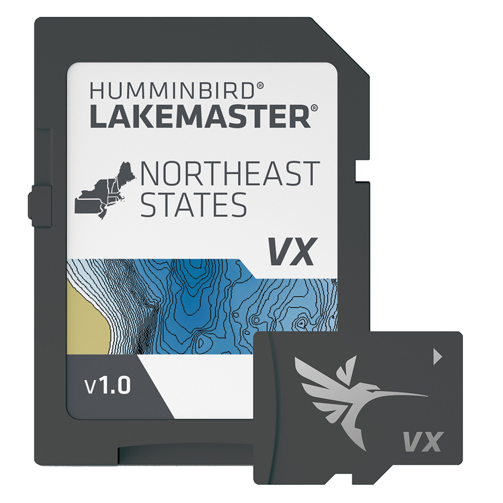
Humminbird LakeMaster VX - Northeast States
Humminbird LakeMaster VX - Northeast States
Online
$149.99 for Each
Retail $149.99
Mfr PN: 601007-1
Stock: 42
|
LakeMaster® VX - Northeast States An upgraded mapping solution in Humminbird LakeMaster VX to help anglers understand what is under the water’s surface better than ever before. For decades, Humminbird LakeMaster® has led the charge with the most accurate and advanced mapping available for anglers. Now, LakeMaster is taking it to an entirely new level with the introduction of Humminbird LakeMaster maps with VX Technology. The LakeMaster name has been praised among anglers for having the highest quality mapping for fishing, often collected by a team of GIS analyst cartographers. Now with VX Technology, LakeMaster maps are packed with more information than ever before, including five new customizable color palettes, exceptional map performance, and a powerful combination of features. The LakeMaster lineup maintains the same regions as the current lineup, but now includes SmartStrike technology as a feature, allowing anglers to enter search parameters like season, time of day, temperature, and targeted fish species to create a custom chart that highlights areas of the map where fish are most likely to be biting. LakeMaster also includes customizable Chart Presets, Depth Highlight, Shallow Water Highlight, Water Level Offset, and One-Boat Network capability. LakeMaster has been the go-to road map for anglers, and compared to the competition, what you see on the map is actually on the lake bottom. With LakeMaster with VX Technology, Humminbird LakeMaster solidifies its place as the most accurate and detailed fishing map on the market. Features:
|
Online
$149.99 for Each
Retail $149.99
Mfr PN: 601007-1
Stock: 42
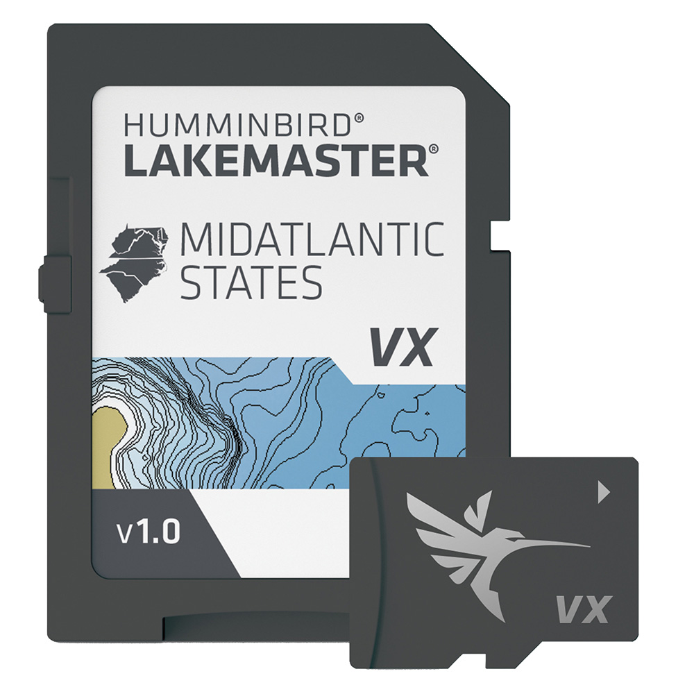
Humminbird LakeMaster VX - Mid-Atlantic States
Humminbird LakeMaster VX - Mid-Atlantic States
Online
$149.99 for Each
Retail $149.99
Mfr PN: 601004-1
Stock: 36
|
LakeMaster® VX - Mid-Atlantic States An upgraded mapping solution in Humminbird LakeMaster VX to help anglers understand what is under the water’s surface better than ever before. For decades, Humminbird LakeMaster® has led the charge with the most accurate and advanced mapping available for anglers. Now, LakeMaster is taking it to an entirely new level with the introduction of Humminbird LakeMaster maps with VX Technology. The LakeMaster name has been praised among anglers for having the highest quality mapping for fishing, often collected by a team of GIS analyst cartographers. Now with VX Technology, LakeMaster maps are packed with more information than ever before, including five new customizable color palettes, exceptional map performance, and a powerful combination of features. The LakeMaster lineup maintains the same regions as the current lineup, but now includes SmartStrike technology as a feature, allowing anglers to enter search parameters like season, time of day, temperature, and targeted fish species to create a custom chart that highlights areas of the map where fish are most likely to be biting. LakeMaster also includes customizable Chart Presets, Depth Highlight, Shallow Water Highlight, Water Level Offset, and One-Boat Network capability. LakeMaster has been the go-to road map for anglers, and compared to the competition, what you see on the map is actually on the lake bottom. With LakeMaster with VX Technology, Humminbird LakeMaster solidifies its place as the most accurate and detailed fishing map on the market. Features:
|
Online
$149.99 for Each
Retail $149.99
Mfr PN: 601004-1
Stock: 36

Garmin Drive 53 Traffic
Garmin Drive 53 Traffic
Online
$214.16 for EA
Mfr PN: 010-02858-01
Stock: 35
|
Garmin Drive 53 & Traffic No matter your journey Garmin Drive 53 & Traffic keeps you on track and focused on the road ahead. With its sleek 5 high-resolution touchscreen display easily pinch and zoom then let this GPS navigator take you all the way.
|
Online
$214.16 for EA
Mfr PN: 010-02858-01
Stock: 35
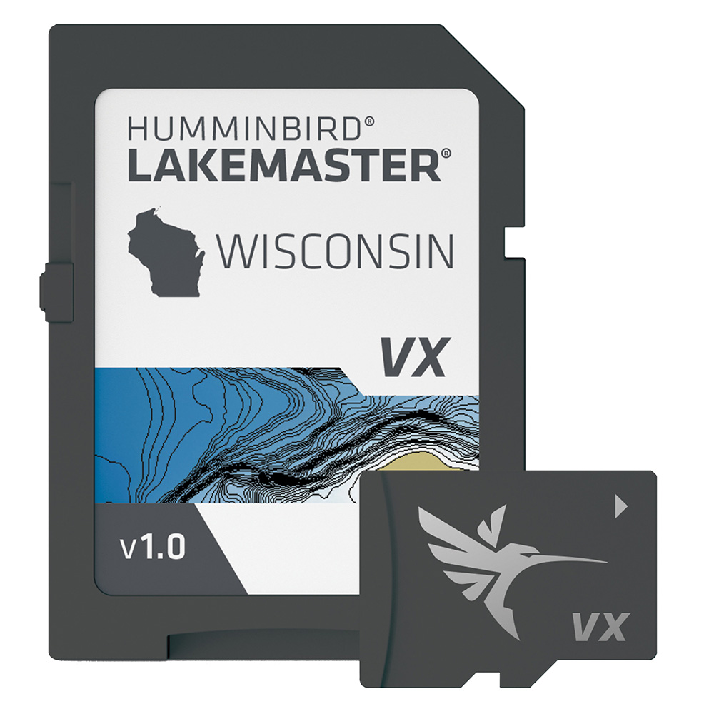
Humminbird LakeMaster VX - Wisconsin
Humminbird LakeMaster VX - Wisconsin
Online
$149.99 for Each
Retail $149.99
Mfr PN: 601010-1
Stock: 28
|
LakeMaster® VX - Wisconsin An upgraded mapping solution in Humminbird LakeMaster VX to help anglers understand what is under the water’s surface better than ever before. For decades, Humminbird LakeMaster® has led the charge with the most accurate and advanced mapping available for anglers. Now, LakeMaster is taking it to an entirely new level with the introduction of Humminbird LakeMaster maps with VX Technology. The LakeMaster name has been praised among anglers for having the highest quality mapping for fishing, often collected by a team of GIS analyst cartographers. Now with VX Technology, LakeMaster maps are packed with more information than ever before, including five new customizable color palettes, exceptional map performance, and a powerful combination of features. The LakeMaster lineup maintains the same regions as the current lineup, but now includes SmartStrike technology as a feature, allowing anglers to enter search parameters like season, time of day, temperature, and targeted fish species to create a custom chart that highlights areas of the map where fish are most likely to be biting. LakeMaster also includes customizable Chart Presets, Depth Highlight, Shallow Water Highlight, Water Level Offset, and One-Boat Network capability. LakeMaster has been the go-to road map for anglers, and compared to the competition, what you see on the map is actually on the lake bottom. With LakeMaster with VX Technology, Humminbird LakeMaster solidifies its place as the most accurate and detailed fishing map on the market. Features:
|
Online
$149.99 for Each
Retail $149.99
Mfr PN: 601010-1
Stock: 28

Navionics Platinum+ NPUS007R - U.S. East
Navionics Platinum+ NPUS007R - U.S. East
Online
$149.98 for Each
Retail $249.99
Mfr PN: 010-C1370-40
Stock: 23
|
NPUS007R - U.S. East Get the world’s No. 1 choice in marine mapping - with the best, most up-to-date Navionics Platinum+ cartography on your compatible chartplotter. For offshore or inland waters, this all-in-one solution offers detail-rich integrated mapping of coastal waters, lakes, rivers and more. Get SonarChart™ 1’ (0.5 meter) HD bathymetry maps, advanced features such as dock-to-dock route guidance technology, live mapping and Plotter Sync to provide wireless access to daily updates. The Navionics Chart Installer software also ensures the freshest chart data every time out. Navionics dock-to-dock route guidance solutions give you a suggested path to follow through channels, inlets, marina entrances and more. Multiple shading options aid in shallow water navigation and make it easy to highlight a target depth range for the best fishing spots. Navionics Platinum+™ charts include all the content of Navionics®+ cartography, with integrated offshore and inland mapping, 42,000+ lakes and additional viewing options for relief shading, satellite imagery with SonarChart shading overlay, 3D perspective view, aerial photos, and more. Chart Code - NPUS007R Coverage Area: Coverage of the lakes, rivers and coasts of Connecticut, Delaware, Illinois, Indiana, Kentucky, Maine, Maryland, Massachusetts, Michigan, New Hampshire, New Jersey, New York, North Carolina, Ohio, Pennsylvania, Rhode Island, South Carolina, Tennessee, Vermont, Virginia and West Virginia. Features:
Compatibility:
Technical Specifications:
In the Box:
1Subscription not required for SonarChart Live mapping feature on some chartplotter models; requires latest chartplotter firmware release. 2Dock-to-dock Route Guidance is for planning purposes only and does not replace safe navigation operations. *Navionics+ and Platinum+ cards are not compatible with Garmin chartplotters. *Sold as an Individual This product may not be returned to the original point of purchase. Please contact the manufacturer directly with any issues or concerns. |
Online
$149.98 for Each
Retail $249.99
Mfr PN: 010-C1370-40
Stock: 23

myGEKOgear Solar Backup Cam
myGEKOgear Solar Backup Cam
Online
$169.99 for EA
Retail $271.26
Mfr PN: SBC01
Stock: 23
|
Make backing out of a spot easy and quick with the SOLARST. This solar powered back up camera is quick and simple to install it doesn t involve any complicated wiring. Simply screw on the camera to your license plate and adjust the lens to your perfect view. View your rear with the 4.3? colored LCD monitor ensuring your path is clear before reversing. Compatible with most cars and trucks. Start backing out with peace in mind.
|
Online
$169.99 for EA
Retail $271.26
Mfr PN: SBC01
Stock: 23

myGEKOgear Surv Dash Cam
myGEKOgear Surv Dash Cam
Online
$179.99 for EA
Retail $303.16
Mfr PN: GO95132G
Stock: 23
|
Capture your front and rear in 1080p full HD clear video and provide evidence in cases when you need it the most. Instantly view download and share your footage from the mobile App on your smartphone. Monitor your vehicle 24/7 when it s in park with the OBD II power cable. This frees up your cigarette power port and it s easy to DIY without needing professional hardwire. Using a magnetic adhesive mount conveniently remove the dash cam and clip it back in without taking off the entire mount. Supports up to 64GB recording several hours of footage. Includes a 32GB microSD so you can instantly installation and start capturing your drives
|
Online
$179.99 for EA
Retail $303.16
Mfr PN: GO95132G
Stock: 23

myGEKOgear 2K 3 Chnl Dash Cam
myGEKOgear 2K 3 Chnl Dash Cam
Online
$249.99 for EA
Retail $396.80
Mfr PN: GOSP32G
Stock: 23
|
The Scout Pro is a Rideshare friendly 3-channel dash cam shooting in 2K (Front) + 1080p (In-Cabin) + 1080p (Rear). In 2-channel mode it can record in 4K (front) + 1080p (rear). With an OBD II power cable included in the package monitor your car 24/7 using the built-in parking mode for security. Connect your dash cam and smartphone through the mobile app to view download and share your footage directly. Track all driven locations and incident location with GPS logging . Supports up to 256GB of storage allowing hours of footage before it s loop recorded over. A 32GB microSD card is included in the box so you can immediately start installation and recording all drives. Provide clear video evidence of what s happening around your vehicle in times when you need it the most
|
Online
$249.99 for EA
Retail $396.80
Mfr PN: GOSP32G
Stock: 23
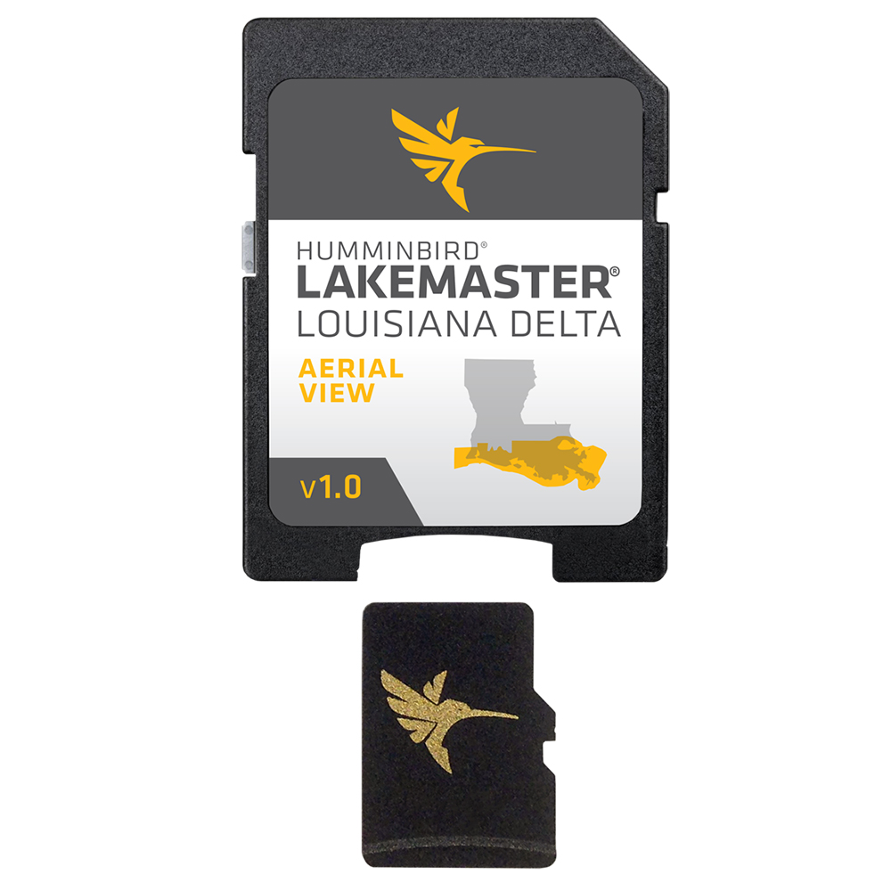
Humminbird LakeMaster Aerial Satellite View - Louisiana Delta
Humminbird LakeMaster Aerial Satellite View - Louisiana Delta
Online
$149.99 for Each
Retail $149.99
Mfr PN: 600050-1
Stock: 20
|
LakeMaster Aerial Satellite View - Louisiana Delta
Humminbird® LakeMaster® now offers high resolution aerial photography of the Louisiana Delta on one micro card (with SD adaptor). Always know where you are with real life aerial views of shorelines, waterways, landmarks, obstructions, roads, marinas, canals, and channels. Also includes nav aids, lake names, points of interest and more!
|
Online
$149.99 for Each
Retail $149.99
Mfr PN: 600050-1
Stock: 20

myGEKOgear 4K STARVIS Dash Cam
myGEKOgear 4K STARVIS Dash Cam
Online
$169.99 for EA
Retail $271.26
Mfr PN: GO53532G
Stock: 17
|
Record the road ahead in true 4K with the Orbit 535 offering you sharp and clear video so you won t miss those license plates and signs. Equipped with the Sony Starvis sensor rendering a well-lit video at night. Easily view download and share your footage via dash cam to your smartphone through Wi-Fi and mobile app connection. Easily remove and clip in your dash cam with the magnetic adhesive mount. Supporting up to 128GB storing hours of footage. Our package includes a free 32GB microSD card so you can start installation and record immediately. Capture your everyday commute and provide evidence when you need it the most.
|
Online
$169.99 for EA
Retail $271.26
Mfr PN: GO53532G
Stock: 17
Garmin 010-02038-02 DriveSmart 65 6.95" GPS Navigator with Bluetooth, Wi-Fi & Traffic Alerts
Garmin 010-02038-02 DriveSmart 65 6.95" GPS Navigator with Bluetooth, Wi-Fi & Traffic Alerts
Online
$327.99 for EA
Mfr PN: 010-02038-02
Stock: 16
|
• GPS navigator with traffic alerts;• Edge-to-edge display;• Preloaded, detailed maps of North America with map updates;• Simple on-screen menus & bright, clear maps show 3D buildings & terrain;• Garmin(R) Traffic is ready to use right out of the box--without use of a smartphone;• Voice-activated & ability to pair with a compatible & GPS-enabled smartphone for hands-free calling, smart notifications & live traffic via the Garmin Drive(TM) app;• Road trip-ready with The HISTORY Channel(R) database of notable historic sites, a US national parks directory, TripAdvisor(R) traveler ratings & millions of Foursquare(R) POIs;• Built-in Wi-Fi(R) for map & software updates without a computer;• Provides spoken turn-by-turn directions, Garmin Real Directions(TM) landmark guidance & helpful driver alerts to encourage safer driving;• Compatible with optional BC(TM) 30 wireless backup camera;• Includes traffic receiver/vehicle power cable, vehicle suction-cup mount, USB cable & quick-start manual;
|
Online
$327.99 for EA
Mfr PN: 010-02038-02
Stock: 16

Garmin Navionics+ NSSA012R Brazil
Garmin Navionics+ NSSA012R Brazil
Online
$99.98 for Each
Retail $149.99
Mfr PN: 010-C1453-20
Stock: 16
|
Navionics+™ NSSA012R Brazil Featuring vibrant colors, a streamlined interface, and combined coastal/inland content with a popular Navionics® style color palette, Garmin Navionics+ cartography makes it easy to plot courses with the world’s No. 1 name in marine mapping.
Coverage Detailed coverage of the coast of Brazil. Also including the Amazon River from Benjamin Constant to the Atlantic Ocean. All-In-One Map Solution for Garmin Chartplotters Access detail-rich mapping of coastal features, lakes, rivers, and more. Integrated Garmin and Navionics® content offers coverage for boaters worldwide. Daily Chart Updates Charts are constantly being enhanced with new and amended content — as many as 5,000 updates are made every day. The one-year subscription includes access to daily chart updates via the ActiveCaptain app. Auto Guidance+ Technology Combining the best of Garmin and Navionics automatic routing features, built-in Auto Guidance+ technology2 gives users a suggested dock-to-dock path to follow through channels, inlets, marina entrances, and more. Depth Range Shading High-resolution depth range shading lets users select up to 10 color-shaded options and view the designated target depths at a glance. Up to 1’ Contours For improved fishing and navigation, up to 1' contours provide a clear depiction of bottom structure for improved fishing charts and enhanced detail in swamps, canals, harbors, marinas, and more. Shallow Water Shading To give a clear picture of shallow waters to avoid, this feature allows for shading at a user-defined depth. ActiveCaptain Community Community-sourced content provides useful POIs, such as marinas, anchorages, hazards, businesses, and more. Get recommendations from boaters with firsthand experience of the local environment. 1Auto Guidance+ is for planning purposes only and does not replace safe navigation operations |
Online
$99.98 for Each
Retail $149.99
Mfr PN: 010-C1453-20
Stock: 16

Garmin Navionics+ NSSA011R South America (North)
Garmin Navionics+ NSSA011R South America (North)
Online
$99.98 for Each
Retail $149.99
Mfr PN: 010-C1452-20
Stock: 16
|
Navionics+™ NSSA011R South America (North) Featuring vibrant colors, a streamlined interface, and combined coastal/inland content with a popular Navionics® style color palette, Garmin Navionics+ cartography makes it easy to plot courses with the world’s No. 1 name in marine mapping.
Coverage Detailed coverage of the entire coast of Panama, including the Canal. Coastal coverage of Peru, Ecuador, Columbia, Venezuela, Trinidad and Tobago, Guyana, Suriname, and French Guiana. All-In-One Map Solution for Garmin Chartplotters Access detail-rich mapping of coastal features, lakes, rivers, and more. Integrated Garmin and Navionics® content offers coverage for boaters worldwide. Daily Chart Updates Charts are constantly being enhanced with new and amended content — as many as 5,000 updates are made every day. The one-year subscription includes access to daily chart updates via the ActiveCaptain app. Auto Guidance+ Technology Combining the best of Garmin and Navionics automatic routing features, built-in Auto Guidance+ technology2 gives users a suggested dock-to-dock path to follow through channels, inlets, marina entrances, and more. Depth Range Shading High-resolution depth range shading lets users select up to 10 color-shaded options and view the designated target depths at a glance. Up to 1’ Contours For improved fishing and navigation, up to 1' contours provide a clear depiction of bottom structure for improved fishing charts and enhanced detail in swamps, canals, harbors, marinas, and more. Shallow Water Shading To give a clear picture of shallow waters to avoid, this feature allows for shading at a user-defined depth. ActiveCaptain Community Community-sourced content provides useful POIs, such as marinas, anchorages, hazards, businesses, and more. Get recommendations from boaters with firsthand experience of the local environment. 1Auto Guidance+ is for planning purposes only and does not replace safe navigation operations |
Online
$99.98 for Each
Retail $149.99
Mfr PN: 010-C1452-20
Stock: 16

Garmin Navionics+ NSSA010R Central America & Caribbean
Garmin Navionics+ NSSA010R Central America & Caribbean
Online
$99.98 for Each
Retail $149.99
Mfr PN: 010-C1451-20
Stock: 16
|
Navionics+™ NSSA010R Central America & Caribbean Featuring vibrant colors, a streamlined interface, and combined coastal/inland content with a popular Navionics® style color palette, Garmin Navionics+ cartography makes it easy to plot courses with the world’s No. 1 name in marine mapping.
Coverage Detailed coverage of the west coast of Mexico from Tijuana to Panama. Including the Panama Canal in its entirety. East Coast coverage from Panama to Brownsville, TX. Also includes detailed Caribbean coverage of the Far Bahamas, Turks & Caicos, Cuba, Jamaica, the Caymans, Haiti, the Dominican Republic, Puerto Rico, and the Lesser Antilles to Grenada. All-In-One Map Solution for Garmin Chartplotters Access detail-rich mapping of coastal features, lakes, rivers, and more. Integrated Garmin and Navionics® content offers coverage for boaters worldwide. Daily Chart Updates Charts are constantly being enhanced with new and amended content — as many as 5,000 updates are made every day. The one-year subscription includes access to daily chart updates via the ActiveCaptain app. Auto Guidance+ Technology Combining the best of Garmin and Navionics automatic routing features, built-in Auto Guidance+ technology2 gives users a suggested dock-to-dock path to follow through channels, inlets, marina entrances, and more. Depth Range Shading High-resolution depth range shading lets users select up to 10 color-shaded options and view the designated target depths at a glance. Up to 1’ Contours For improved fishing and navigation, up to 1' contours provide a clear depiction of bottom structure for improved fishing charts and enhanced detail in swamps, canals, harbors, marinas, and more. Shallow Water Shading To give a clear picture of shallow waters to avoid, this feature allows for shading at a user-defined depth. Raster Cartography NOAA raster cartography3 is available for some U.S. waters as a free downloadable feature via the ActiveCaptain app to provide paper chart-like views on a plotter. ActiveCaptain Community Community-sourced content provides useful POIs, such as marinas, anchorages, hazards, businesses, and more. Get recommendations from boaters with firsthand experience of the local environment. 1Auto Guidance+ is for planning purposes only and does not replace safe navigation operations 2Raster cartography cannot be viewed on echoMAP™ CHIRP and ECHOMAP™ Plus combos but can be viewed on mobile devices via the ActiveCaptain mobile app 3Subscription required; a one-year subscription, which is included with the purchase of the Navionics Vision+ mapping solution, lets users access daily chart updates and download additional content or premium features included with the cartography product |
Online
$99.98 for Each
Retail $149.99
Mfr PN: 010-C1451-20
Stock: 16
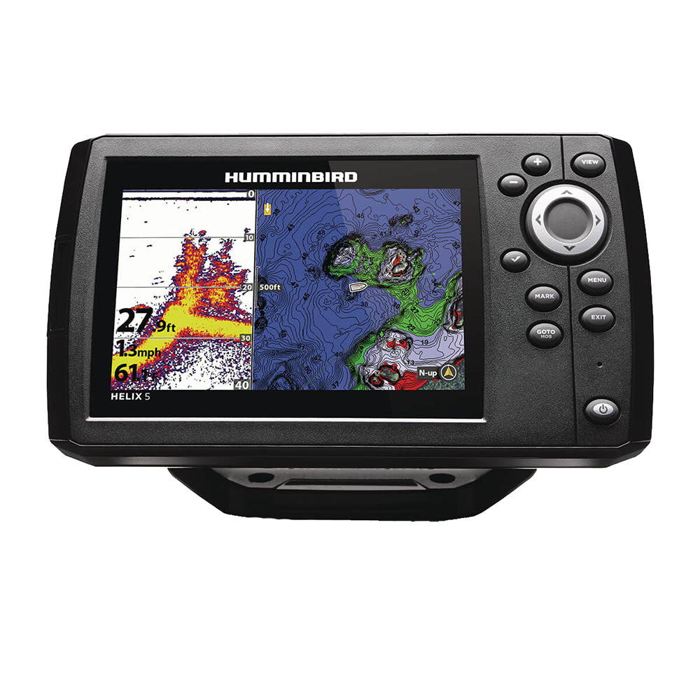
Humminbird HELIX 5 CHIRP/GPS Combo G3
Humminbird HELIX 5 CHIRP/GPS Combo G3
Online
$370.06 for Each
Mfr PN: 411660-1
Stock: 16
|
HELIX 5 CHIRP/GPS Combo G3 If fishing is in your DNA, there's no such thing as "too early" or "too far." The HELIX 5 Series answers the call with an uncompromising 5" widescreen, color display. This HELIX 5 CHIRP GPS G3 model features Dual Spectrum CHIRP 2D sonar, internal GPS with Humminbird Basemap, and AutoChart Live built-in, with additional compatibility for Humminbird and Navionics premium fishing charts. Features:
Specifications:
|
Online
$370.06 for Each
Mfr PN: 411660-1
Stock: 16
Humminbird LakeMaster VX - Western States
Humminbird LakeMaster VX - Western States
Online
$149.99 for Each
Retail $149.99
Mfr PN: 601009-1
Stock: 16
|
LakeMaster® VX - Western States An upgraded mapping solution in Humminbird LakeMaster VX to help anglers understand what is under the water’s surface better than ever before. For decades, Humminbird LakeMaster® has led the charge with the most accurate and advanced mapping available for anglers. Now, LakeMaster is taking it to an entirely new level with the introduction of Humminbird LakeMaster maps with VX Technology. The LakeMaster name has been praised among anglers for having the highest quality mapping for fishing, often collected by a team of GIS analyst cartographers. Now with VX Technology, LakeMaster maps are packed with more information than ever before, including five new customizable color palettes, exceptional map performance, and a powerful combination of features. The LakeMaster lineup maintains the same regions as the current lineup, but now includes SmartStrike technology as a feature, allowing anglers to enter search parameters like season, time of day, temperature, and targeted fish species to create a custom chart that highlights areas of the map where fish are most likely to be biting. LakeMaster also includes customizable Chart Presets, Depth Highlight, Shallow Water Highlight, Water Level Offset, and One-Boat Network capability. LakeMaster has been the go-to road map for anglers, and compared to the competition, what you see on the map is actually on the lake bottom. With LakeMaster with VX Technology, Humminbird LakeMaster solidifies its place as the most accurate and detailed fishing map on the market. Features:
|
Online
$149.99 for Each
Retail $149.99
Mfr PN: 601009-1
Stock: 16
Humminbird LakeMaster VX - Mid-South States
Humminbird LakeMaster VX - Mid-South States
Online
$149.99 for Each
Retail $149.99
Mfr PN: 601005-1
Stock: 16
|
LakeMaster® VX - Mid-South States An upgraded mapping solution in Humminbird LakeMaster VX to help anglers understand what is under the water’s surface better than ever before. For decades, Humminbird LakeMaster® has led the charge with the most accurate and advanced mapping available for anglers. Now, LakeMaster is taking it to an entirely new level with the introduction of Humminbird LakeMaster maps with VX Technology. The LakeMaster name has been praised among anglers for having the highest quality mapping for fishing, often collected by a team of GIS analyst cartographers. Now with VX Technology, LakeMaster maps are packed with more information than ever before, including five new customizable color palettes, exceptional map performance, and a powerful combination of features. The LakeMaster lineup maintains the same regions as the current lineup, but now includes SmartStrike technology as a feature, allowing anglers to enter search parameters like season, time of day, temperature, and targeted fish species to create a custom chart that highlights areas of the map where fish are most likely to be biting. LakeMaster also includes customizable Chart Presets, Depth Highlight, Shallow Water Highlight, Water Level Offset, and One-Boat Network capability. LakeMaster has been the go-to road map for anglers, and compared to the competition, what you see on the map is actually on the lake bottom. With LakeMaster with VX Technology, Humminbird LakeMaster solidifies its place as the most accurate and detailed fishing map on the market. Features:
|
Online
$149.99 for Each
Retail $149.99
Mfr PN: 601005-1
Stock: 16

Garmin Navionics+ NSSA004L - Mexico, the Caribbean to Brazil - Inland & Coastal Marine Chart
Garmin Navionics+ NSSA004L - Mexico, the Caribbean to Brazil - Inland & Coastal Marine Chart
Online
$149.98 for Each
Retail $199.99
Mfr PN: 010-C1285-20
Stock: 15
|
Navionics+™ NSSA004L - Mexico, the Caribbean to Brazil - Inland & Coastal Marine Chart Get the world’s No. 1 choice in the marine mapping with the best, most up-to-date Navionics®+ cartography on your compatible chartplotter. Featuring vibrant colors, a streamlined interface and combined coastal/inland content with a popular Navionics® style color palette, Garmin Navionics+ cartography makes it easy to plot your course. Multiple shading options aid in shallow water navigation and make it easy to highlight a target depth range for the best fishing spots. Fully customizable with various chart layers, overlay combinations and up to 10 color-shaded target depth ranges to scope out the best fishing spots. When you purchase a new Garmin Navionics+ or Garmin Navionics Vision+ cartography product, a one-year subscription is included. Chart Code - NSSA004L Coverage Area: Coastal coverage of Mexico, Central America and Brazil. Coverage includes the US Gulf Coast and the eastern US coast to Savannah, GA; Bermuda; the Bahamas; Cuba; Hispaniola; Puerto Rico and the Virgin Islands; the Windward and Leeward Islands; Jamaica; the Panama Canal, the western coast of South America to Arica, Chile; the Galapagos Islands; the Revillagigedo Islands; the Ilha Fernando de Noronha; the Saint Peter and Saint Paul Archipelago and the Rocas Atoll. Features:
Compatibility:
Technical Specifications:
In the Box:
1Auto Guidance+ is for planning purposes only and does not replace safe navigation operations *Sold as an Individual |
Online
$149.98 for Each
Retail $199.99
Mfr PN: 010-C1285-20
Stock: 15

Garmin Navionics+ NSSA005L - Chile, Argentina & Easter Island - Marine Chart
Garmin Navionics+ NSSA005L - Chile, Argentina & Easter Island - Marine Chart
Online
$149.98 for Each
Retail $199.99
Mfr PN: 010-C1286-20
Stock: 15
|
Navionics+™ NSSA005L - Chile, Argentina and Easter Island - Marine Chart Get the world’s No. 1 choice in the marine mapping with the best, most up-to-date Navionics®+ cartography on your compatible chartplotter. Featuring vibrant colors, a streamlined interface and combined coastal/inland content with a popular Navionics® style color palette, Garmin Navionics+ cartography makes it easy to plot your course. Multiple shading options aid in shallow water navigation and make it easy to highlight a target depth range for the best fishing spots. Fully customizable with various chart layers, overlay combinations and up to 10 color-shaded target depth ranges to scope out the best fishing spots. When you purchase a new Garmin Navionics+ or Garmin Navionics Vision+ cartography product, a one-year subscription is included. Chart Code - NSSA005L Coverage Area: Coastal coverage of South America from Arica, Chile to Rio Grande, Brazil. Coverage includes Easter Island, Cape Horn, the Falkland Islands/Islas Malvinas, the South Georgia Islands, the South Sandwich Islands and the Rio de la Plata. Features:
Compatibility:
Technical Specifications:
In the Box:
1Auto Guidance+ is for planning purposes only and does not replace safe navigation operations *Sold as an Individual |
Online
$149.98 for Each
Retail $199.99
Mfr PN: 010-C1286-20
Stock: 15
|
|
|
|
Copyright © 1999-2024 BuilderDepot, Inc. Site Designed and Maintained by Inline Internet Systems, Inc. |